|
|
Post by jaeforceone on Mar 20, 2010 23:45:17 GMT -5
 By null at 2010-03-20 I made this rock pile diagram from the 2nd bathroom->baithouse-> 3rd bathroom -every T extending line represents a guesstimate to the rockpile and are not representive of rock pile length -every dot represents a pylon -every L represents a light pole -CW represents a crosswalk -L+ is the same -L1 is followed by L2 (lights are usually 4 pylons apart unless its in front of a building its every two pylons) Its only the middle stretch Couldn't find a good aerial on the end of the pier. No numbers either but its a good thing to print out and document how many and where you caught on a certain day. Enjoy! |
|
|
|
Post by goindeep on Mar 21, 2010 14:46:55 GMT -5
|
|
|
|
Post by jaeforceone on Mar 21, 2010 18:27:49 GMT -5
the reason i made this was because people were just assuming every row of pilings that were crossed were rock piles. If you use this chart it particulary isn't the case. I'd to be freelining to open sand between rockpiles. that picture of the end of SSP is great but it has no scale Wouldn't be able to document size ratios.
|
|
|
|
Post by filletnrelease on Mar 22, 2010 14:18:27 GMT -5
If you look at the aerial you will see that the rock piles are very evenly spaced. Also note the relationship to the bait house and bathrooms. This relates very closely to the 6 piling setup with the angled piles. It hasn't failed me yet, don't care what you say.
|
|
|
|
Post by fishonfishoff on Mar 23, 2010 19:28:54 GMT -5
Yup.........what Jack said.
|
|
|
|
Post by gerard1031 on Mar 24, 2010 7:26:25 GMT -5
Next time you're out on the pier at around high noon, take your drawing and drive along the pier to validate your map, you can generally see the rock piles as darker shapes....the other more painful method of course is to throw and reel and see where you do and don't get hung up. Also used to be that the numbers were still visible...that was the best.
|
|
|
|
Post by jaeforceone on Mar 24, 2010 9:52:34 GMT -5
haha yeah i plan on validating my accuracy, I don't doubt completely that the whole cross piling thing works, its just that I don't think its entirely accurate. I was going for accuracy not perfect. From the aerial views they are in fact evenly spaced but if you can zoom as much as you can with the pictures, the rockpiles are in fact off a pylon or two sometimes. thats what I THINK at least, Im not saying im completely right. going out to check
|
|
|
|
Post by arrantzale on Mar 24, 2010 10:00:24 GMT -5
nice diagram, u should do the north side too lol. i have 2 spots on the north side i like going to cuz i never get hung up, but i also know that works against me in terms of structure for fish to hide in. one question though, how far is it approx from the pier until the rocks start?
|
|
|
|
Post by havetofish on Mar 24, 2010 10:27:39 GMT -5
Anywhere from 25-50 yds, depending on which rock pile. See scale on bottom right  |
|
|
|
Post by filletnrelease on Mar 24, 2010 10:52:25 GMT -5
Nice image John. Don't remember one with a scale before.
|
|
|
|
Post by gerard1031 on Mar 24, 2010 11:24:19 GMT -5
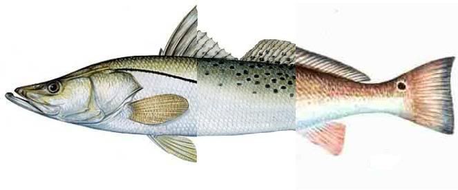
I remember watching either Capt. Bill's Hooked on Fishing or maybe Average Angler, they showed a scuba shot of a few of the rubble piles....just amazing that you can throw in them and NOT get snagged....also a huge advantage for a lurking grouper to snatch, turn and hold on. Come to think of it there's a you tube vid of some of the pilings...check this out..also just no wonder sometimes your bait gets picked to nothing... Part 1 www.youtube.com/watch?v=_8imnMaTMGcPart 2 www.youtube.com/watch?v=WQaDt2djX6I |
|
|
|
Post by havetofish on Mar 24, 2010 12:05:22 GMT -5
nice video...but, his comment is "This was a dive on some Sunshine Skyway Bridge Pilings that were dumped in about 50 feet of water." The Skyway Piers rockpiles are no where near that depth. I believe they did dump debris in other locations though. SSP  NSP  |
|
|
|
Post by arrantzale on Mar 24, 2010 15:41:44 GMT -5
wow u guys are full of good stuff today. depth charts, videos, scaled pictures lol.
ive never targeted grouper yet but i plan to this spring. is it a good plan to free line a pinner over one of those rockpiles?
|
|
|
|
Post by gerard1031 on Mar 24, 2010 16:29:17 GMT -5
Yea I heard that but thought they might be off, heck even the bay on either side of the ship channel isn't 50 ft deep and doubt they'd throw rubble into the channel itself. As for freelining the pinner....that is the number one method....almost always at least a bite, and deters all the bait stealers. Attachments:
|
|
Tommy
Rod Polisher
 Hooked[Mo0:0]
Posts: 142
|
Post by Tommy on Mar 27, 2010 12:01:20 GMT -5
None of you have ever noticed there is a ruler in Google Earth, measures in all dimensions from inches to miles, even gives compass direction
|
|